
Walk a Union Hill-Novelty Hill Street
A street directory search begins with the address, not a broad name list. King County eReal Property identifies the tax parcel and current recorded owner. Parcel Viewer displays the same parcel in relation to the lots around it. Landmark then connects a parcel or owner name with recorded deeds. Voter records have stricter access: My Voter Information authenticates one voter, and the statewide extract has a formal request and restricted-use process. Historical directories may supply household evidence, but rural roads are unevenly covered.
Follow this order and save each official identifier. It separates the owner of Union Hill-Novelty Hill land from a tax-mail recipient, a former owner, or a person who merely shares a surname.
- Enter the full address in eReal Property. Save the parcel number, owner, situs address, and tax-mail address as separate facts.
- Open Parcel Viewer and click the subject lot plus each adjoining parcel. Note plats, parcel boundaries, and report links.
- Search Landmark by parcel and owner. Follow grantor and grantee names through dated transfers.
- Check permits by address for dated building activity, but do not treat an applicant or contact as proof of residence.
- For an older household, try regional criss-cross directories, property cards, assessment rolls, and newspapers under both modern and historic road names.
Search Union Hill-Novelty Hill Addresses
King County eReal Property offers four practical entry routes. The address route is quickest for one known house. Owner search finds parcels tied to a person or entity. Parcel search is the most exact. Condo-name search helps when one street address contains many units. The returned account may include sales, assessed values, building facts, and a mailing address.
| Search field | Input | Street-directory use |
|---|---|---|
| Address | Number and street | Locate the situs parcel |
| Parcel | King County parcel number | Open the exact account |
| Owner | Person or entity name | Find linked parcels |
| Condo name | Project name | Narrow shared-address units |
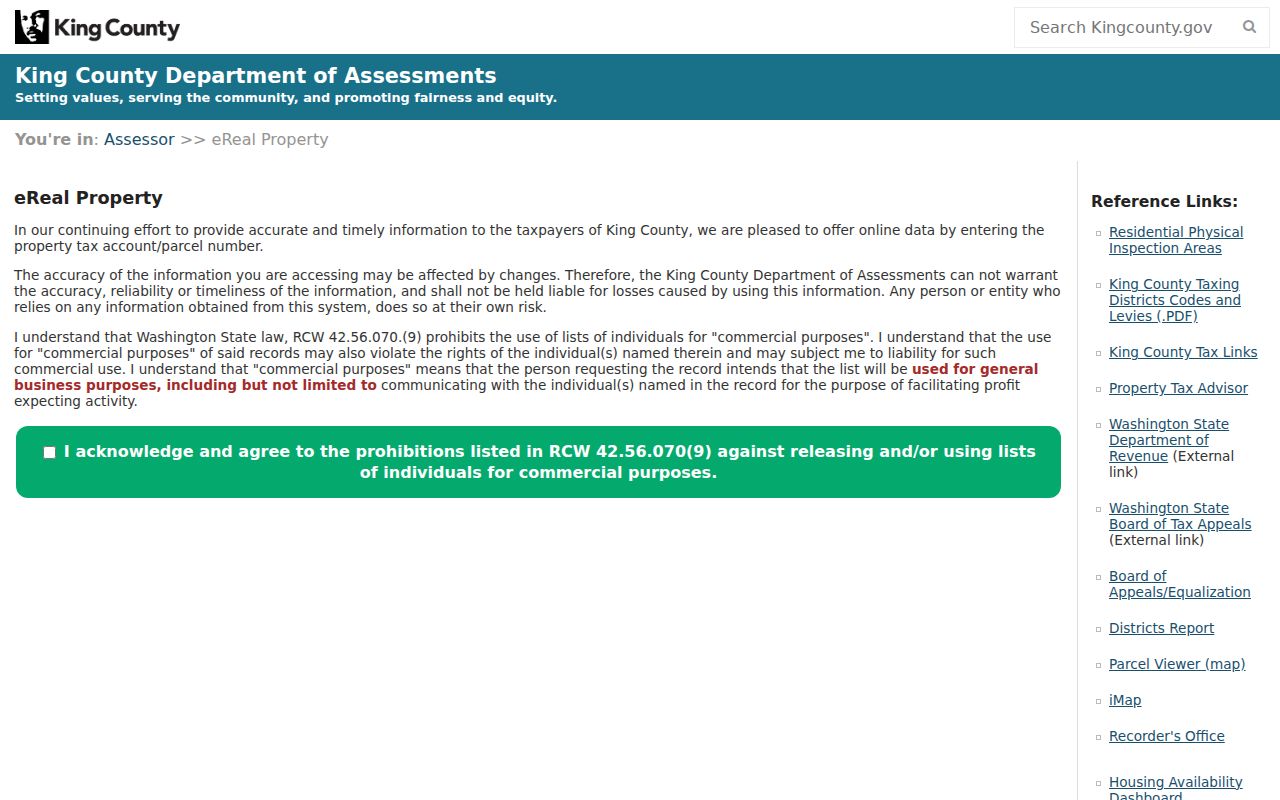
The eReal Property screen is the main address gateway for the Union Hill-Novelty Hill street directory.
Treat ownership as one record layer. The page does not name every person who occupies the site.
Map Union Hill-Novelty Hill Parcels
King County Parcel Viewer resolves the street into mapped lots. Search by address or parcel, zoom to the road, then click parcels one at a time. The viewer can link to parcel reports and supports a visual check of adjacency. It is especially helpful where a Redmond mailing label, the Census-designated place, and unincorporated jurisdiction do not match.
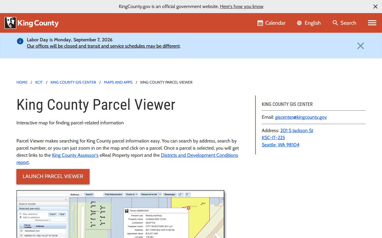
The official Parcel Viewer page introduces the map and report tools used for a street-by-street survey.
Map clicks reveal legal neighbors, meaning adjoining parcels, without implying that parcel owners are social neighbors or current occupants.
Four Address Labels Differ
A Union Hill-Novelty Hill address can carry four labels that answer four questions. The mailing city comes from postal service. The situs address names the physical site for county records. The ZIP code organizes delivery. The Census CDP boundary describes a statistical place. None alone proves municipal jurisdiction.
- Parcel
- A county-mapped unit of land with its own identifier.
- Situs address
- The physical location assigned to the parcel, distinct from the tax mailing address.
- Plat
- A recorded map dividing land into lots, tracts, roads, and easements.
- Criss-cross directory
- A printed directory ordered by street and house number rather than surname.
Use the parcel number and legal description when the labels conflict. Those keys follow the land through name changes more reliably than a postal city.
Union Hill-Novelty Hill Road Names
Historic sources may call today’s SR 202 by PSH 2 or Redmond-Fall City Highway. NE Union Hill Road, NE Novelty Hill Road, Ames Lake-Carnation, and Tolt Hill also serve as useful search terms. A 1937 highway reference can connect an old newspaper item or deed description with the modern corridor. No official street-renumbering chronology specific to the CDP was located, so do not invent one.
Run the old and new road forms separately in newspapers and archive catalogs. Then use a plat, section-township-range description, or parcel history to test whether both labels point to the same land. The street directory remains evidence-led even when house numbers changed or were absent from a rural record.
Deeds Along Union Hill-Novelty Hill Streets
King County Landmark Web indexes recorded documents from 1976 forward. Search an owner as grantee to find an acquisition, then search that seller as grantee to move one step farther back. Parcel number, legal description, recording date, document type, and recording number can disambiguate common names.
The portal’s document-search routes extend a modern street directory into a deed chain. Most online images begin August 1, 1991, even though the index begins in 1976. Save each recording number before requesting an older image.
Before the Union Hill Index
The 1976 Landmark boundary is not the beginning of King County land records. King County Archives holds the General Recordings Index and microfilm for 1853 through 1975. Its staff can work from names, dates, document types, legal descriptions, and known recording references. Researchers may arrange an appointment or use the scan and copy-order route.
Ask narrowly. Give the road variants, parcel or legal description, likely parties, and date range. Washington State Archives’ Puget Sound Regional Branch may add assessment rolls and property cards. A property card from roughly 1937 through 1972 may show a building photograph, sketch, construction date, and assessment details, but it may not supply the owner chain.
Union Hill-Novelty Hill Permit Clues
King County Local Services handles permits for unincorporated land. The King County Permitting Portal can be searched for applications, permits, and inspection status. Address-based results may date additions, demolitions, land-use work, or inspections. They can help separate two similar parcels or explain a sharp change in assessor building data.
A permit contact, applicant, contractor, or former owner is not necessarily a resident. Use the permit number, work description, issue date, and parcel link as evidence about the site. For records not displayed online, use the agency’s records-request channel under the Washington Public Records Act. RCW 42.56.520 generally requires an initial response within five business days, which may acknowledge the request or give a reasonable estimate rather than produce every record at once.
Union Hill-Novelty Hill Street Records
Each address-keyed source answers a narrow question. Combine them in sequence, and state which conclusion comes from which record. The Union Hill-Novelty Hill street directory should never turn a tax roll into a claim about all household members.
| Address source | Record keeper | Street evidence | Access route |
|---|---|---|---|
| eReal Property | King County Assessor | Parcel, owner, mailing and situs fields, sales, building facts | Free portal |
| Parcel Viewer | King County GIS Center | Parcel lines, adjacency, map position, report links | Free viewer |
| Recorded documents | King County Recorder | Named parties, dates, document types, legal descriptions | Landmark index; Archives fallback |
| Permits | King County Local Services | Applications, work history, inspections, parcel clues | Portal or records request |
| Historic address sources | Libraries and archives | Past households, routes, property cards, assessment rolls | Digital, library, appointment, or copy request |
The parcel number ties assessor, GIS, deed, and permit material together. Names and dates then lead to directories, voter registers, newspapers, probate indexes, and court files. When a source is silent, record that gap instead of filling it with an assumption.
Area 71 Organizes Street Searches
King County Assessor calls its larger valuation area Redmond Ridge & Environs, Area 71. The 2026 report divides the landscape into Redmond Ridge and Redmond Ridge East, a corridor between NE Union Hill Road and SR 202, and a northern area below Redmond Ridge described through equestrian and view properties. These are appraisal subareas, not resident districts.
The divisions still help organize a large by-street project. Sample roads within one appraisal area, log parcel results, then move to the next. Compare coverage without assuming that the county subarea, CDP boundary, ZIP code, and postal city align. This geographic distinction is one of the most useful safeguards in a Union Hill-Novelty Hill address search.
Historic Union Hill-Novelty Hill Households
No dedicated Union Hill-Novelty Hill directory collection was found. Seattle Public Library’s digitized city directories run from 1867 through 1940 and include a 1928 reverse directory, but their regional coverage must be checked entry by entry. KCLS adds newspapers, Sanborn maps, genealogy databases, and local microfilm. The Puget Sound Regional Branch holds Polk directories, property cards, voter registers, assessment rolls, and school censuses.
Search Redmond, Novelty Hill, Union Hill, East Redmond, highway terms, and rural route labels. Old directories are covered more fully on the Union Hill-Novelty Hill city directory page. For the street chain, record only the exact printed address, name, directory year, and any occupation or spouse field, then compare those facts with the parcel and deed record.
Limits of the Union Hill-Novelty Hill Street Directory
No public source provides a complete, current list of every person on a Union Hill-Novelty Hill street. Property records focus on owners. Tax mail can go elsewhere. Public voter access is limited by statute and purpose. Association sites may name boards but keep member rosters private. Driver and vehicle address data are protected by federal law, and the research did not locate a public utility-customer list.
Washington’s Address Confidentiality Program may substitute an address for an eligible participant. Court sealing, vital-record restrictions, and other exemptions also create lawful absences. A street directory result should distinguish confirmed ownership, dated historical occupancy, public civic role, and unresolved possibility.
Lawful use. Use Union Hill-Novelty Hill address records only for lawful personal research. Washington law prohibits stalking and harassment.